DUNEX-RT
DUring Nearshore Event eXperiment (DUNEX) Realtime is a dynamic, 36-hour forecast model of the waves, currents, and water levels in coastal North Carolina, USA. The domain includes the shelf and coast of the Outer Banks, and Albemarle Pamlico estuarine system. This project is intended to provide coastal forecast information as a resource for researchers studying nearshore processes on both the ocean and estuary sides of the Outer Banks, and is a component of the DUNEX project by the US Coastal Research Program. A 36-hour forecast is provided every 6 hours with an approximately 8-hour delay from the start time at model hour 0.
Results
Model results during the crossing September 2019 crossing of Hurricane Dorian, along with additional implementation details and an analysis of the effects of wind field variability are published in the Journal of Geophysical Research: Oceans
Rey, A., and Mulligan, R.P., Influence of Hurricane Wind Field Variability on Real‐time Forecast Simulations of the Coastal Environment, Journal of Geophysical Research: Oceans, 126(1), e2020JC016489, https://doi.org/10.1029/2020JC016489
Model
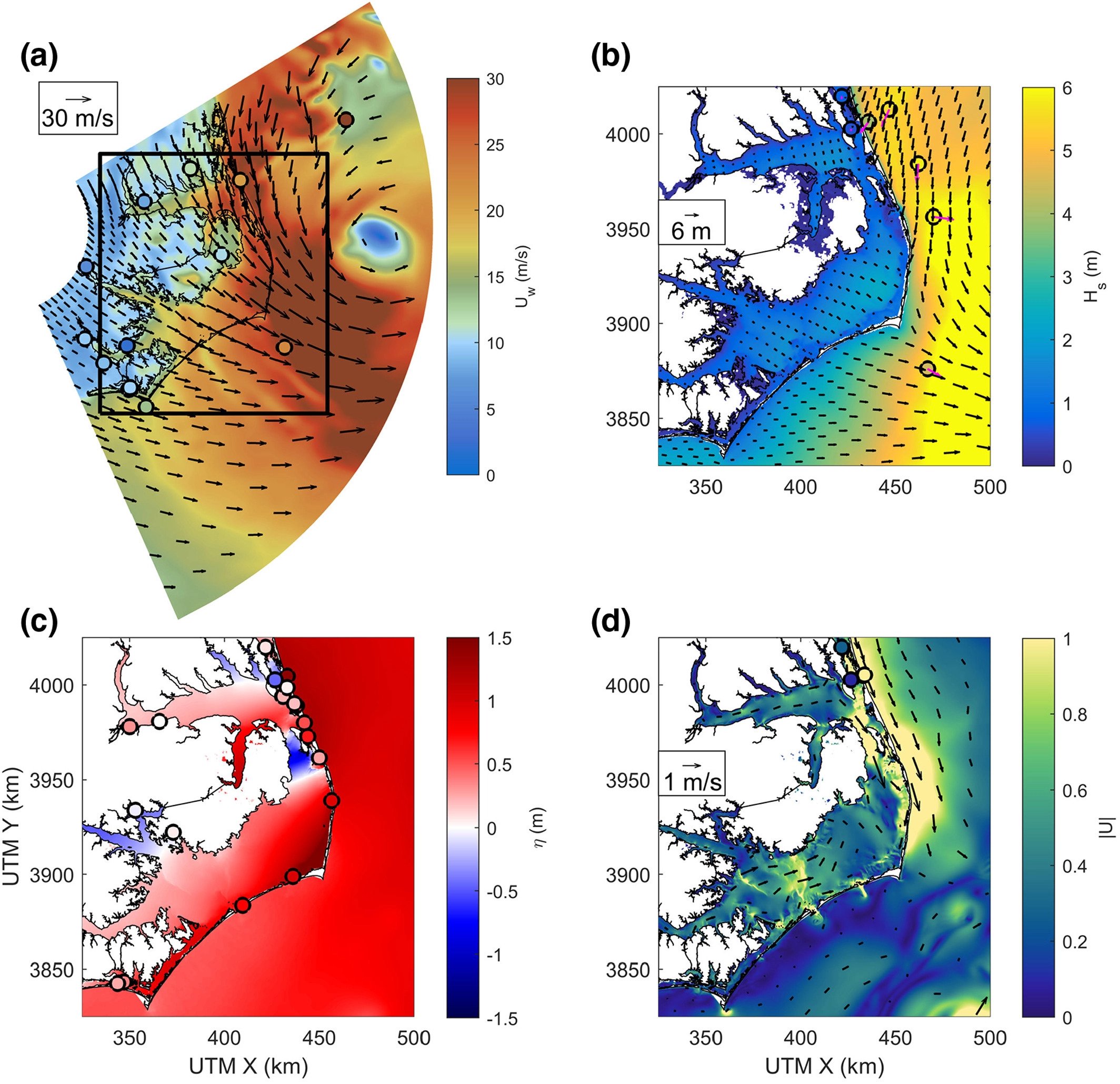
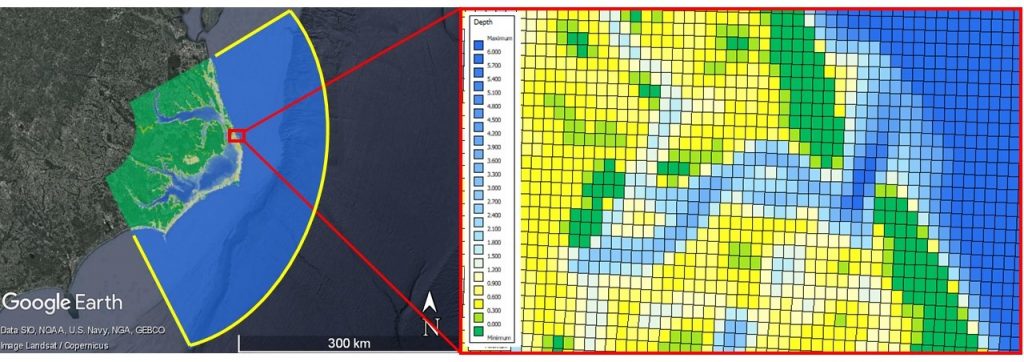
Delft3D is the operational model for this project. This open-source numerical model is produced by Deltares and has been validated in a wide variety of coastal environments. The model runs in depth-averaged (2D) mode with a 30-second time step on a 24-core cluster at Queen’s University, and the grid has a horizontal resolution of approximately 100 m. The model grid, domain, and bathymetry are visualized here, with boundaries shown in yellow.
Delft3D is coupled with SWAN model (also called Delft3D-WAVE), a spectral wave mode developed by the TU Delft. Waves computations are coupled every 3-hours on a horizontal grid with a 250 m resolution, covering the entire hydrodynamic model domain.
Inputs
Three large scale forecast models were used to provide the forcing conditions and boundary conditions for this project:
- High Resolution Rapid Refresh (HRRR) provides winds, atmospheric pressures, and precipitation every hour on a 3-km grid over the entire model domain, precipitation over land set to zero.
- Extratropical Surge and Tide Operational Forecast System (ESTOFS) . provides water levels at ocean boundaries every hour at 20-km intervals for all boundary points with depths greater than 10 m.
- WaveWatch 3 model provides ocean wave boundary conditions along the same boundaries as water levels, using the swell component of the The Northwest Atlantic grid at 20-km intervals every 3 hours.
- Navy Coastal Ocean Model provides current information at the north and south offshore boundaries.
Validation
Model results are validated in real time at 10-minute intervals with observations of waves, currents, and water levels across the system. These results are provided by the US Army Corps of Engineers Field Research Facility, NOAA, and the National Data Buoy Center.
Limitations
Validation for this model is ongoing, and results presented here should be considered experimental and are for research purposes only. Official forecasts can be found at the US National Weather Service website.
Funding Acknowledgements
Funding by the US Office of Naval Research (ONR Global), the Natural Sciences and Engineering Research Council of Canada (NSERC), and the Faculty of Engineering and Applied Science at Queen’s University are gratefully acknowledged.